
八紘嶺 topographic map
Interactive map
Click on the map to display elevation.
About this map
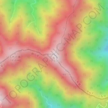
Name: 八紘嶺 topographic map, elevation, terrain.
Location: 八紘嶺, 早川町, 南巨摩郡, 山梨県, 日本 (35.32650 138.33559 35.32660 138.33569)
Average elevation: 1,542 m
Minimum elevation: 1,052 m
Maximum elevation: 1,894 m
Other topographic maps
Click on a map to view its topography, its elevation and its terrain.