
笊ヶ岳 topographic map
Interactive map
Click on the map to display elevation.
About this map
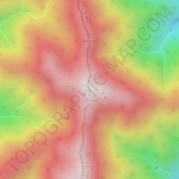
Name: 笊ヶ岳 topographic map, elevation, terrain.
Location: 笊ヶ岳, 早川町, 南巨摩郡, 山梨県, 日本 (35.42411 138.25943 35.42421 138.25953)
Average elevation: 2,147 m
Minimum elevation: 1,447 m
Maximum elevation: 2,588 m
笊ヶ岳(ざるがたけ)は、山梨県と静岡県とにまたがる赤石山脈白峰南嶺の標高2,629 mの山。日本二百名山及び山梨百名山に選定されている。
Other topographic maps
Click on a map to view its topography, its elevation and its terrain.