
昭和の森公園 topographic map
Interactive map
Click on the map to display elevation.
About this map
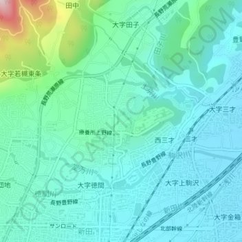
Name: 昭和の森公園 topographic map, elevation, terrain.
Location: 昭和の森公園, 長野市, 長野県, 中部地方, 日本 (36.68387 138.23312 36.69037 138.23765)
Average elevation: 396 m
Minimum elevation: 332 m
Maximum elevation: 683 m
Other topographic maps
Click on a map to view its topography, its elevation and its terrain.