
伊勢町 topographic map
Interactive map
Click on the map to display elevation.
About this map
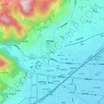
Name: 伊勢町 topographic map, elevation, terrain.
Location: 伊勢町, 長野市, 長野県, 中部地方, 380-0851, 日本 (36.63850 138.16925 36.67850 138.20925)
Average elevation: 440 m
Minimum elevation: 348 m
Maximum elevation: 818 m
Other topographic maps
Click on a map to view its topography, its elevation and its terrain.