
莇ヶ岳 topographic map
Interactive map
Click on the map to display elevation.
About this map
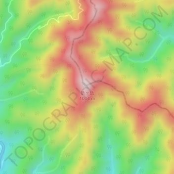
Name: 莇ヶ岳 topographic map, elevation, terrain.
Location: 莇ヶ岳, 周南市, 山口県, 日本 (34.33258 131.77771 34.33268 131.77781)
Average elevation: 736 m
Minimum elevation: 512 m
Maximum elevation: 974 m
Other topographic maps
Click on a map to view its topography, its elevation and its terrain.