
黒髪島 topographic map
Interactive map
Click on the map to display elevation.
About this map
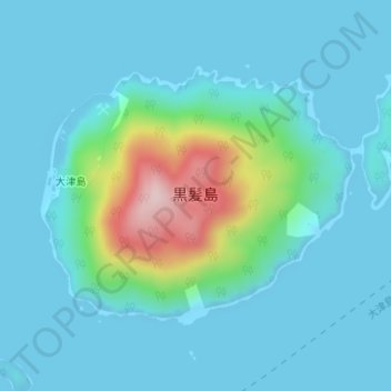
Name: 黒髪島 topographic map, elevation, terrain.
Location: 黒髪島, 周南市, 山口県, 日本 (34.02044 131.72635 34.03837 131.75263)
Average elevation: 45 m
Minimum elevation: -4 m
Maximum elevation: 296 m
Other topographic maps
Click on a map to view its topography, its elevation and its terrain.