
剣山 topographic map
Interactive map
Click on the map to display elevation.
About this map
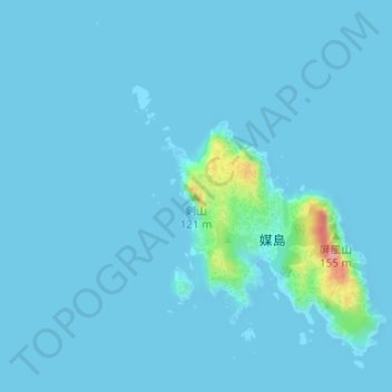
Name: 剣山 topographic map, elevation, terrain.
Location: 剣山, 東京都, 日本 (27.63063 142.17261 27.63073 142.17271)
Average elevation: 7 m
Minimum elevation: -1 m
Maximum elevation: 132 m
Other topographic maps
Click on a map to view its topography, its elevation and its terrain.