
中央山 topographic map
Interactive map
Click on the map to display elevation.
About this map
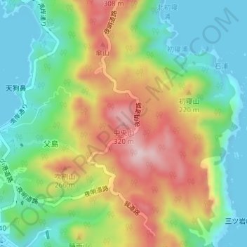
Name: 中央山 topographic map, elevation, terrain.
Location: 中央山, 東京都, 日本 (27.07326 142.21852 27.07336 142.21862)
Average elevation: 129 m
Minimum elevation: -3 m
Maximum elevation: 321 m
Other topographic maps
Click on a map to view its topography, its elevation and its terrain.