
父島 topographic map
Interactive map
Click on the map to display elevation.
About this map
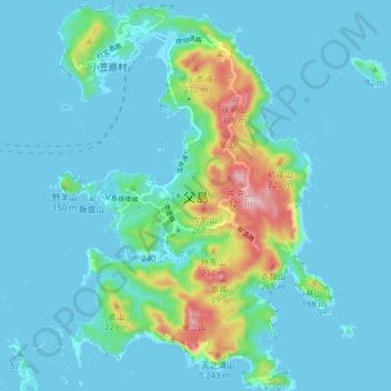
Name: 父島 topographic map, elevation, terrain.
Location: 父島, 東京都, 100-2101, 日本 (27.03572 142.18140 27.10607 142.23790)
Average elevation: 45 m
Minimum elevation: -2 m
Maximum elevation: 321 m
Other topographic maps
Click on a map to view its topography, its elevation and its terrain.