
西多摩郡 topographic map
Interactive map
Click on the map to display elevation.
About this map
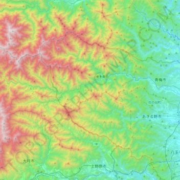
Name: 西多摩郡 topographic map, elevation, terrain.
Location: 西多摩郡, 東京都, 日本 (35.66602 138.94286 35.89842 139.38154)
Average elevation: 742 m
Minimum elevation: 113 m
Maximum elevation: 2,045 m
Other topographic maps
Click on a map to view its topography, its elevation and its terrain.