
子持山 topographic map
Interactive map
Click on the map to display elevation.
About this map
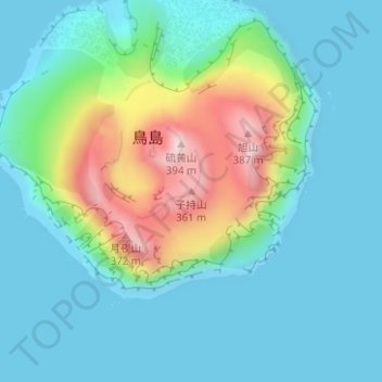
Name: 子持山 topographic map, elevation, terrain.
Location: 子持山, 東京都, 日本 (30.48046 140.30374 30.48056 140.30384)
Average elevation: 88 m
Minimum elevation: 0 m
Maximum elevation: 372 m
Other topographic maps
Click on a map to view its topography, its elevation and its terrain.