
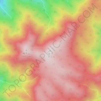
姫次 topographic map
Interactive map
Click on the map to display elevation.
About this map
Name: 姫次 topographic map, elevation, terrain.
Location: 姫次, 相模原市, 神奈川県, 日本 (35.51065 139.13411 35.51075 139.13421)
Average elevation: 1,158 m
Minimum elevation: 636 m
Maximum elevation: 1,421 m
姫次(ひめつぎ・ひめつぐ)は、丹沢山地北部、神奈川県相模原市にある標高1,433 mの山である。
Other topographic maps
Click on a map to view its topography, its elevation and its terrain.