
沼本ダム topographic map
Interactive map
Click on the map to display elevation.
About this map
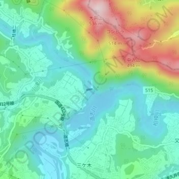
Name: 沼本ダム topographic map, elevation, terrain.
Location: 沼本ダム, 緑区, 相模原市, 神奈川県, 日本 (35.60198 139.22959 35.60219 139.23063)
Average elevation: 234 m
Minimum elevation: 118 m
Maximum elevation: 520 m
Other topographic maps
Click on a map to view its topography, its elevation and its terrain.