
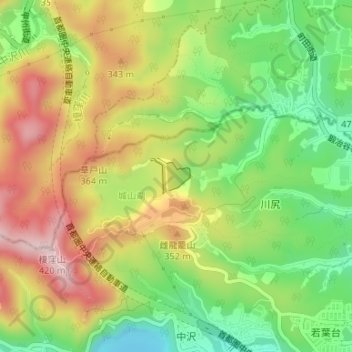
本沢ダム topographic map
Interactive map
Click on the map to display elevation.
About this map
Name: 本沢ダム topographic map, elevation, terrain.
Location: 本沢ダム, 川尻, 緑区, 相模原市, 神奈川県, 日本 (35.60657 139.27461 35.60926 139.27785)
Average elevation: 255 m
Minimum elevation: 122 m
Maximum elevation: 404 m
Other topographic maps
Click on a map to view its topography, its elevation and its terrain.