
広面字蟹沢 topographic map
Interactive map
Click on the map to display elevation.
About this map
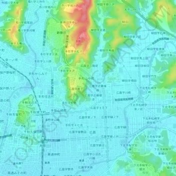
Name: 広面字蟹沢 topographic map, elevation, terrain.
Location: 広面字蟹沢, 秋田市, 秋田県, 010-0041, 日本 (39.70895 140.12312 39.74895 140.16312)
Average elevation: 21 m
Minimum elevation: 5 m
Maximum elevation: 94 m
Other topographic maps
Click on a map to view its topography, its elevation and its terrain.