
土崎港御蔵町 topographic map
Interactive map
Click on the map to display elevation.
About this map
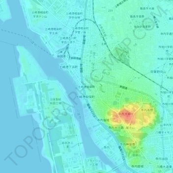
Name: 土崎港御蔵町 topographic map, elevation, terrain.
Location: 土崎港御蔵町, 秋田市, 秋田県, 011-0946, 日本 (39.72763 140.04849 39.76763 140.08849)
Average elevation: 8 m
Minimum elevation: -3 m
Maximum elevation: 54 m
Other topographic maps
Click on a map to view its topography, its elevation and its terrain.