
大町ダム topographic map
Interactive map
Click on the map to display elevation.
About this map
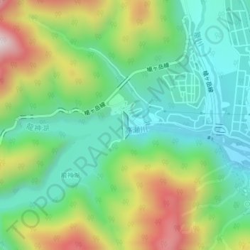
Name: 大町ダム topographic map, elevation, terrain.
Location: 大町ダム, 大町市, 長野県, 日本 (36.51312 137.78170 36.51607 137.78273)
Average elevation: 1,018 m
Minimum elevation: 798 m
Maximum elevation: 1,442 m
Other topographic maps
Click on a map to view its topography, its elevation and its terrain.