
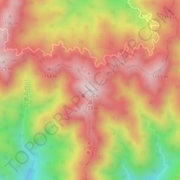
東三方ヶ森 topographic map
Interactive map
Click on the map to display elevation.
About this map
Name: 東三方ヶ森 topographic map, elevation, terrain.
Location: 東三方ヶ森, 今治市, 愛媛県, 日本 (33.90274 132.95975 33.90284 132.95985)
Average elevation: 968 m
Minimum elevation: 615 m
Maximum elevation: 1,204 m
Other topographic maps
Click on a map to view its topography, its elevation and its terrain.