
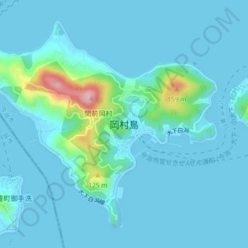
岡村島 topographic map
Interactive map
Click on the map to display elevation.
About this map
Name: 岡村島 topographic map, elevation, terrain.
Location: 岡村島, 今治市, 愛媛県, 日本 (34.17455 132.86147 34.19731 132.89426)
Average elevation: 19 m
Minimum elevation: -1 m
Maximum elevation: 176 m
Other topographic maps
Click on a map to view its topography, its elevation and its terrain.