
佐久間湖 topographic map
Interactive map
Click on the map to display elevation.
About this map
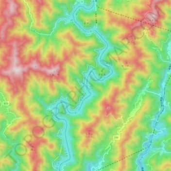
Name: 佐久間湖 topographic map, elevation, terrain.
Location: 佐久間湖, 浜松市, 北設楽郡, 静岡県, 日本 (35.09932 137.78633 35.19109 137.83108)
Average elevation: 566 m
Minimum elevation: 177 m
Maximum elevation: 1,090 m
Other topographic maps
Click on a map to view its topography, its elevation and its terrain.