
肃北蒙古族自治县 topographic map
Interactive map
Click on the map to display elevation.
About this map
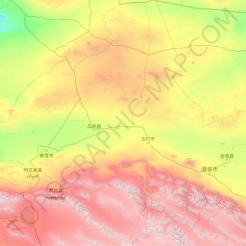
Name: 肃北蒙古族自治县 topographic map, elevation, terrain.
Location: 肃北蒙古族自治县, 酒泉市, 甘肃省, 736300, 中国 (38.41719 94.55074 42.79457 98.33219)
Average elevation: 2,084 m
Minimum elevation: 586 m
Maximum elevation: 5,629 m
Other topographic maps
Click on a map to view its topography, its elevation and its terrain.