
崆峒区 topographic map
Interactive map
Click on the map to display elevation.
About this map
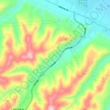
Name: 崆峒区 topographic map, elevation, terrain.
Location: 崆峒区, 平凉市, 甘肃省, 中国 (35.46166 106.75445 35.50166 106.79445)
Average elevation: 1,404 m
Minimum elevation: 1,272 m
Maximum elevation: 1,582 m
Other topographic maps
Click on a map to view its topography, its elevation and its terrain.