
红山窑镇 topographic map
Interactive map
Click on the map to display elevation.
About this map
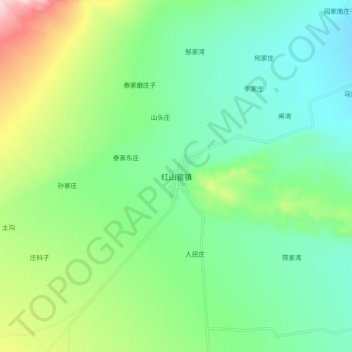
Name: 红山窑镇 topographic map, elevation, terrain.
Location: 红山窑镇, 永昌县, 金昌市, 甘肃省, 737100, 中国 (38.26877 101.54364 38.34877 101.62364)
Average elevation: 2,320 m
Minimum elevation: 2,223 m
Maximum elevation: 2,558 m
Other topographic maps
Click on a map to view its topography, its elevation and its terrain.