
天水市 topographic map
Interactive map
Click on the map to display elevation.
About this map
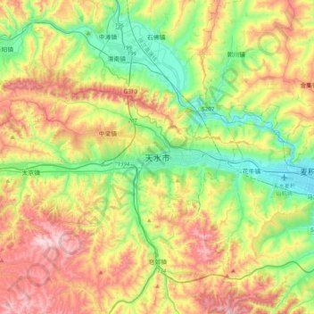
Name: 天水市 topographic map, elevation, terrain.
Location: 天水市, 秦州区, 天水市, 甘肃省, 中国 (34.41975 105.54629 34.73975 105.86629)
Average elevation: 1,458 m
Minimum elevation: 1,079 m
Maximum elevation: 2,042 m
天水地处亚热带和暖温带的过渡地带,加之地形复杂,因此不同区域的气候有明显差别,北部降水明显少于天水南部,冬季气温在冰点上下,因此亦是冬季集中供暖的南界所在,降水较少。夏季稍微闷热,全年降水都在5月至9月集中。一月平均温为−2.0℃;七月平均温22.8℃。在春季期间,天水有时受到扬尘天气的影响,秋季以阴雨天气为主。全年日照时数约1910小时(43.6%)。
Other topographic maps
Click on a map to view its topography, its elevation and its terrain.