
横岳 topographic map
Interactive map
Click on the map to display elevation.
About this map
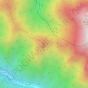
Name: 横岳 topographic map, elevation, terrain.
Location: 横岳, 伊那市, 長野県, 日本 (35.78146 138.18768 35.78156 138.18778)
Average elevation: 1,810 m
Minimum elevation: 1,155 m
Maximum elevation: 2,513 m
Other topographic maps
Click on a map to view its topography, its elevation and its terrain.