
守屋山 topographic map
Interactive map
Click on the map to display elevation.
About this map
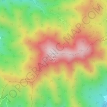
Name: 守屋山 topographic map, elevation, terrain.
Location: 守屋山, 伊那市, 長野県, 日本 (35.96750 138.09335 35.96760 138.09345)
Average elevation: 1,361 m
Minimum elevation: 1,084 m
Maximum elevation: 1,624 m
守屋山(もりやさん)は、長野県諏訪市と伊那市との境にある標高1,651mの山である。
Other topographic maps
Click on a map to view its topography, its elevation and its terrain.