
高津区 topographic map
Interactive map
Click on the map to display elevation.
About this map
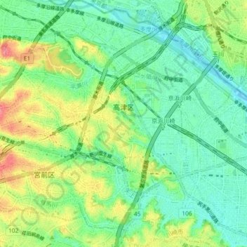
Name: 高津区 topographic map, elevation, terrain.
Location: 高津区, 川崎市, 神奈川県, 日本 (35.56029 139.58639 35.61856 139.64321)
Average elevation: 28 m
Minimum elevation: -1 m
Maximum elevation: 81 m
Other topographic maps
Click on a map to view its topography, its elevation and its terrain.