
上蒲刈島 topographic map
Interactive map
Click on the map to display elevation.
About this map
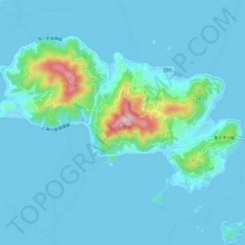
Name: 上蒲刈島 topographic map, elevation, terrain.
Location: 上蒲刈島, 呉市, 広島県, 日本 (34.15784 132.68545 34.20446 132.76548)
Average elevation: 43 m
Minimum elevation: -1 m
Maximum elevation: 440 m
Other topographic maps
Click on a map to view its topography, its elevation and its terrain.