
西中央 topographic map
Interactive map
Click on the map to display elevation.
About this map
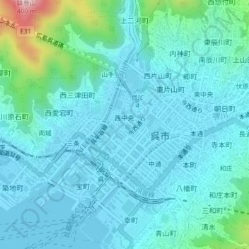
Name: 西中央 topographic map, elevation, terrain.
Location: 西中央, 呉市, 広島県, 日本 (34.24467 132.55510 34.25442 132.56556)
Average elevation: 52 m
Minimum elevation: 0 m
Maximum elevation: 360 m
Other topographic maps
Click on a map to view its topography, its elevation and its terrain.