
三峰山 topographic map
Interactive map
Click on the map to display elevation.
About this map
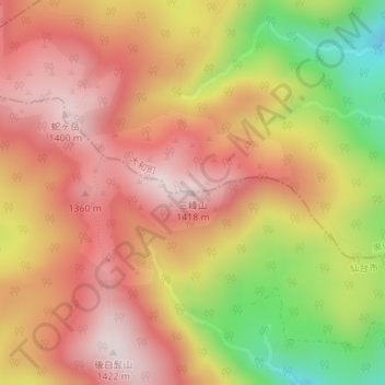
Name: 三峰山 topographic map, elevation, terrain.
Location: 三峰山, 仙台市, 宮城県, 日本 (38.43669 140.64507 38.43679 140.64517)
Average elevation: 1,184 m
Minimum elevation: 854 m
Maximum elevation: 1,396 m
Other topographic maps
Click on a map to view its topography, its elevation and its terrain.