
泉ヶ岳 topographic map
Interactive map
Click on the map to display elevation.
About this map
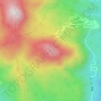
Name: 泉ヶ岳 topographic map, elevation, terrain.
Location: 泉ヶ岳, 仙台市, 宮城県, 982-3225, 日本 (38.41197 140.70870 38.41207 140.70880)
Average elevation: 862 m
Minimum elevation: 536 m
Maximum elevation: 1,226 m
泉ヶ岳(いずみがたけ)は、宮城県仙台市泉区の北西部に位置する標高1175メートルの山である(三角点は1172.18メートル、地図)。船形連峰に連なる。
Other topographic maps
Click on a map to view its topography, its elevation and its terrain.