
若林区 topographic map
Interactive map
Click on the map to display elevation.
About this map
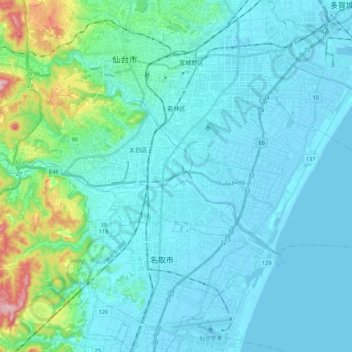
Name: 若林区 topographic map, elevation, terrain.
Location: 若林区, 仙台市, 宮城県, 日本 (38.16108 140.87995 38.26142 141.09506)
Average elevation: 42 m
Minimum elevation: -6 m
Maximum elevation: 323 m
Other topographic maps
Click on a map to view its topography, its elevation and its terrain.