
太白山 topographic map
Interactive map
Click on the map to display elevation.
About this map
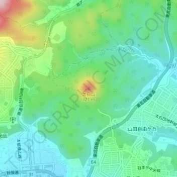
Name: 太白山 topographic map, elevation, terrain.
Location: 太白山, 仙台市, 宮城県, 982-0215, 日本 (38.23488 140.80209 38.23498 140.80219)
Average elevation: 137 m
Minimum elevation: 57 m
Maximum elevation: 348 m
太白山(たいはくさん)は、宮城県仙台市太白区茂庭にある山である。山頂部にある三等三角点「生出森」の標高は320.61メートル(2014年4月1日)。太白区の名称はこの山の名に由来する。仙台富士または名取富士とも呼ばれる。
Other topographic maps
Click on a map to view its topography, its elevation and its terrain.