
蕎麦粒山 topographic map
Interactive map
Click on the map to display elevation.
About this map
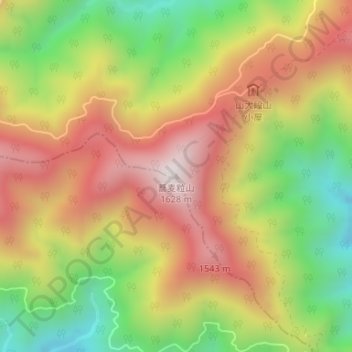
Name: 蕎麦粒山 topographic map, elevation, terrain.
Location: 蕎麦粒山, 川根本町, 榛原郡, 静岡県, 日本 (35.12607 138.03532 35.12617 138.03542)
Average elevation: 1,214 m
Minimum elevation: 799 m
Maximum elevation: 1,605 m
蕎麦粒山(そばつぶやま)は、日本の中部地方南部中央に位置する、静岡県浜松市と川根本町の境界に所在する山。南アルプス深南部の山の一つである。標高1,627m。
Other topographic maps
Click on a map to view its topography, its elevation and its terrain.