
三方嶺 topographic map
Interactive map
Click on the map to display elevation.
About this map
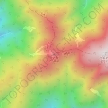
Name: 三方嶺 topographic map, elevation, terrain.
Location: 三方嶺, 川根本町, 榛原郡, 静岡県, 日本 (35.25602 138.14581 35.25612 138.14591)
Average elevation: 1,798 m
Minimum elevation: 1,239 m
Maximum elevation: 2,310 m
Other topographic maps
Click on a map to view its topography, its elevation and its terrain.