
沖黒島 topographic map
Interactive map
Click on the map to display elevation.
About this map
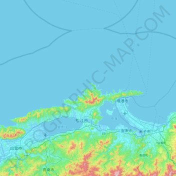
Name: 沖黒島 topographic map, elevation, terrain.
Location: 沖黒島, 松江市, 島根県, 6900401, 日本 (35.26412 132.75719 35.90412 133.39719)
Average elevation: 48 m
Minimum elevation: -5 m
Maximum elevation: 732 m
Other topographic maps
Click on a map to view its topography, its elevation and its terrain.