
Spencer Butte topographic map
Interactive map
Click on the map to display elevation.
About this map
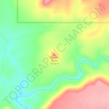
Name: Spencer Butte topographic map, elevation, terrain.
Location: Spencer Butte, Owyhee County, Idaho, USA (42.52317 -116.61739 42.52327 -116.61729)
Average elevation: 1,626 m
Minimum elevation: 1,566 m
Maximum elevation: 1,697 m
Other topographic maps
Click on a map to view its topography, its elevation and its terrain.
Pend Oreille River
Pend Oreille River, Bonner County, Idaho, 83822, USA
Average elevation: 664 m
Garden City
USA > Idaho > Garden City
Garden City, Ada County, Idaho, 83614, USA
Average elevation: 852 m