
Deception Point topographic map
Interactive map
Click on the map to display elevation.
About this map
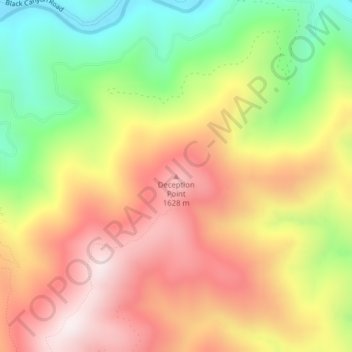
Name: Deception Point topographic map, elevation, terrain.
Location: Deception Point, Clearwater County, Idaho, USA (46.82515 -115.14963 46.82525 -115.14953)
Average elevation: 1,381 m
Minimum elevation: 1,016 m
Maximum elevation: 1,706 m
Other topographic maps
Click on a map to view its topography, its elevation and its terrain.
Pend Oreille River
Pend Oreille River, Bonner County, Idaho, 83822, USA
Average elevation: 664 m
Garden City
USA > Idaho > Garden City
Garden City, Ada County, Idaho, 83614, USA
Average elevation: 852 m