
和林格尔县 topographic map
Interactive map
Click on the map to display elevation.
About this map
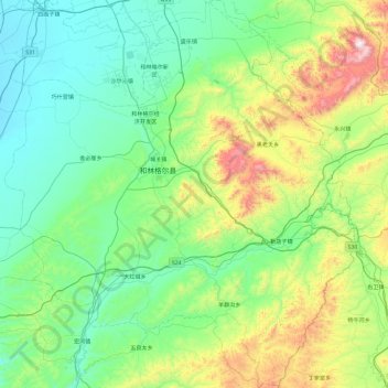
Name: 和林格尔县 topographic map, elevation, terrain.
Location: 和林格尔县, 呼和浩特市, 内蒙古自治区, 011500, 中国 (39.97344 111.44229 40.69308 112.30515)
Average elevation: 1,278 m
Minimum elevation: 1,008 m
Maximum elevation: 2,280 m
Other topographic maps
Click on a map to view its topography, its elevation and its terrain.