
南关区 topographic map
Interactive map
Click on the map to display elevation.
About this map
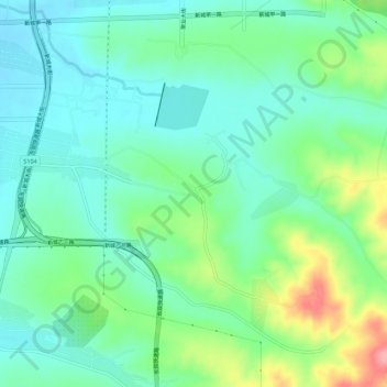
Name: 南关区 topographic map, elevation, terrain.
Location: 南关区, 吉林省, 中国 (43.70751 125.39679 43.74751 125.43679)
Average elevation: 249 m
Minimum elevation: 217 m
Maximum elevation: 331 m
Other topographic maps
Click on a map to view its topography, its elevation and its terrain.