
Henry County topographic map
Interactive map
Click on the map to display elevation.
About this map
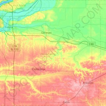
Name: Henry County topographic map, elevation, terrain.
Location: Henry County, Illinois, USA (41.14967 -90.43968 41.58625 -89.85547)
Average elevation: 214 m
Minimum elevation: 170 m
Maximum elevation: 270 m
Other topographic maps
Click on a map to view its topography, its elevation and its terrain.
Garfield Ridge
Garfield Ridge, Chicago, Cook County, Illinois, USA
Average elevation: 184 m
Mount Carmel
USA > Illinois > Mount Carmel
Mount Carmel, Wabash County, Illinois, USA
Average elevation: 128 m
Montague Island
Montague Island, Rockford, Winnebago County, Illinois, 61104, USA
Average elevation: 254 m