
杞梓里镇 topographic map
Interactive map
Click on the map to display elevation.
About this map
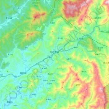
Name: 杞梓里镇 topographic map, elevation, terrain.
Location: 杞梓里镇, 歙县, 黄山市, 安徽省, 中国 (29.89888 118.67766 30.09331 118.84024)
Average elevation: 450 m
Minimum elevation: 105 m
Maximum elevation: 1,318 m
Other topographic maps
Click on a map to view its topography, its elevation and its terrain.