
Luapula River topographic map
Interactive map
Click on the map to display elevation.
About this map
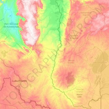
Name: Luapula River topographic map, elevation, terrain.
Location: Luapula River, Luapula Province, Zambia (-12.46016 28.38479 -9.39173 29.90869)
Average elevation: 1,195 m
Minimum elevation: 869 m
Maximum elevation: 1,737 m
Other topographic maps
Click on a map to view its topography, its elevation and its terrain.