
Thank you for supporting this site ❤️
Make a donation
Make a donation
Nchelenge topographic map
Click on the map to display elevation.
Thank you for supporting this site ❤️
Make a donation
Make a donation
About this map
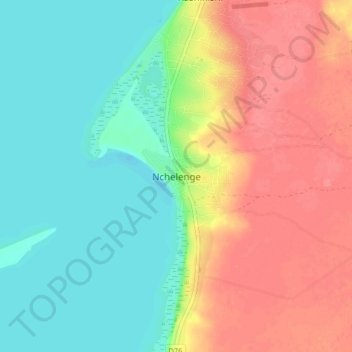
Name: Nchelenge topographic map, elevation, terrain.
Location: Nchelenge, Nchelenge District, Luapula Province, Zambia (-9.38763 28.69526 -9.30763 28.77526)
Average elevation: 946 m
Minimum elevation: 918 m
Maximum elevation: 981 m
Thank you for supporting this site ❤️
Make a donation
Make a donation
Other topographic maps
Click on a map to view its topography, its elevation and its terrain.