
Brée topographic map
Interactive map
Click on the map to display elevation.
About this map
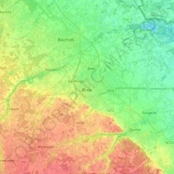
Name: Brée topographic map, elevation, terrain.
Location: Brée, Maaseik, Limbourg, 3960, Belgique (51.10252 5.54645 51.18470 5.71848)
Average elevation: 49 m
Minimum elevation: 25 m
Maximum elevation: 77 m
Other topographic maps
Click on a map to view its topography, its elevation and its terrain.
Houthalen
Belgique > Limbourg > Maaseik > Houthalen-Helchteren
Houthalen, Houthalen-Helchteren, Maaseik, Limbourg, Flandre, 3530, Belgique
Average elevation: 58 m
Sahara de Lommel
Belgique > Limbourg > Maaseik > Lommel
Sahara de Lommel, Lommel, Maaseik, Limbourg, Flandre, 3920, Belgique
Average elevation: 46 m
Kleine-Brogel
Belgique > Limbourg > Maaseik > Peer > Kleine-Brogel
Kleine-Brogel, Peer, Maaseik, Limbourg, Flandre, Belgique
Average elevation: 52 m