
大涌镇 topographic map
Interactive map
Click on the map to display elevation.
About this map
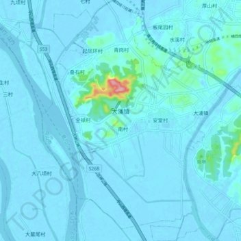
Name: 大涌镇 topographic map, elevation, terrain.
Location: 大涌镇, 中山市, 广东省, 中国 (22.42595 113.23449 22.50872 113.30599)
Average elevation: 8 m
Minimum elevation: -4 m
Maximum elevation: 144 m
大涌鎮地勢中高南北低,中部的丘陵地區,屹立著卓旗山、石龍山、灶地山等,以較偏北的卓旗山最高,海拔164米,南北兩邊是沖積平原,東西兩邊靠河流。
Other topographic maps
Click on a map to view its topography, its elevation and its terrain.