
Bueña topographic map
Interactive map
Click on the map to display elevation.
About this map
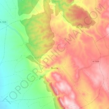
Name: Bueña topographic map, elevation, terrain.
Location: Bueña, Jiloca, Teruel, Aragón, España (40.68218 -1.31739 40.75198 -1.22544)
Average elevation: 1,206 m
Minimum elevation: 985 m
Maximum elevation: 1,424 m
Other topographic maps
Click on a map to view its topography, its elevation and its terrain.
Navarrete del Río
España > Aragón > Jiloca > Calamocha
Navarrete del Río, Calamocha, Jiloca, Teruel, Aragón, 44200, España
Average elevation: 962 m
San Martín del Río
San Martín del Río, Jiloca, Teruel, Aragón, España
Average elevation: 878 m
Ojos Negros
Ojos Negros, Jiloca, Teruel, Aragón, España
Average elevation: 1,178 m
Monreal del Campo
Monreal del Campo, Jiloca, Teruel, Aragón, 44300, España
Average elevation: 993 m