
Bello topographic map
Interactive map
Click on the map to display elevation.
About this map
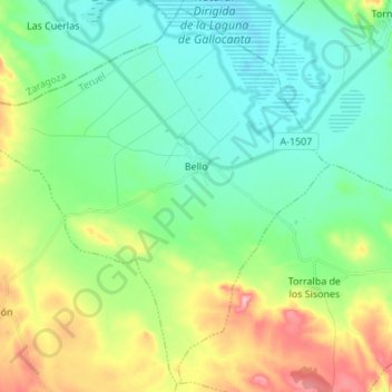
Name: Bello topographic map, elevation, terrain.
Location: Bello, Jiloca, Teruel, Aragón, España (40.86518 -1.58956 40.96412 -1.45346)
Average elevation: 1,037 m
Minimum elevation: 989 m
Maximum elevation: 1,153 m
Other topographic maps
Click on a map to view its topography, its elevation and its terrain.
Navarrete del Río
España > Aragón > Jiloca > Calamocha
Navarrete del Río, Calamocha, Jiloca, Teruel, Aragón, 44200, España
Average elevation: 962 m
San Martín del Río
San Martín del Río, Jiloca, Teruel, Aragón, España
Average elevation: 878 m
Ojos Negros
Ojos Negros, Jiloca, Teruel, Aragón, España
Average elevation: 1,178 m
Monreal del Campo
Monreal del Campo, Jiloca, Teruel, Aragón, 44300, España
Average elevation: 993 m