
Korogwe topographic map
Interactive map
Click on the map to display elevation.
About this map
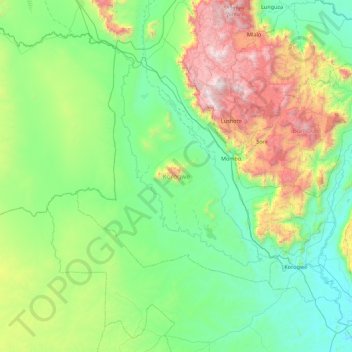
Name: Korogwe topographic map, elevation, terrain.
Location: Korogwe, Tanga, Northern Zone, Tanzanie (-5.37250 37.90308 -4.49389 38.76912)
Average elevation: 747 m
Minimum elevation: 262 m
Maximum elevation: 2,293 m
Other topographic maps
Click on a map to view its topography, its elevation and its terrain.