
Kasterlee topographic map
Interactive map
Click on the map to display elevation.
About this map
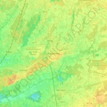
Name: Kasterlee topographic map, elevation, terrain.
Location: Kasterlee, Turnhout, Anvers, Flandre, 2460, Belgique (51.19462 4.86178 51.28690 5.03225)
Average elevation: 18 m
Minimum elevation: 5 m
Maximum elevation: 28 m
Other topographic maps
Click on a map to view its topography, its elevation and its terrain.